Back
Back


2. Workspace overview
User manual
1. Getting started
2. Workspace overview
3. My account
4. Creating & Activating Tracker (Manually)
4.1 Creating & Activating Tracker (Automatically)
4.2. Creating & activating mobile phone
5. Sensor Management
6. Device Management
7. Tools Overview
7.1 Tools Alerts
7.2 Geofences
7.3 Reports
7.4 Send Commands
7.5 POI
7.6 Camera_Media
7.7 Tasks
7.8 Maintenance
7.9 Overview Feature
7.10 Sharing
8. Widgets
Admin manual
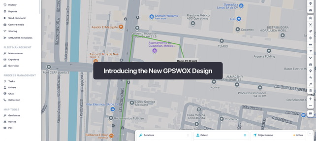
Once logged in, the main page of the platform is a map with controls and a side panel with various features available.
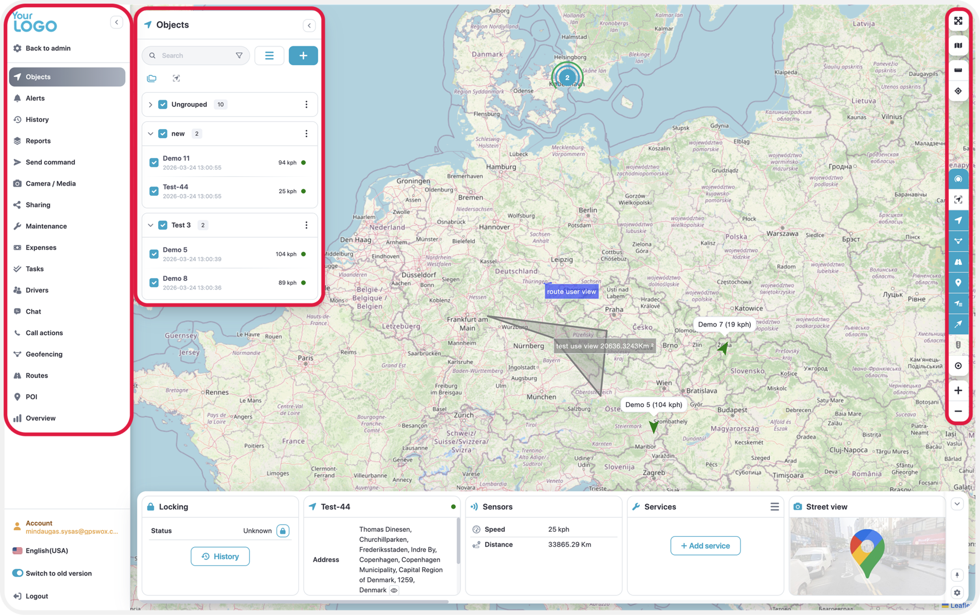
Side Panel
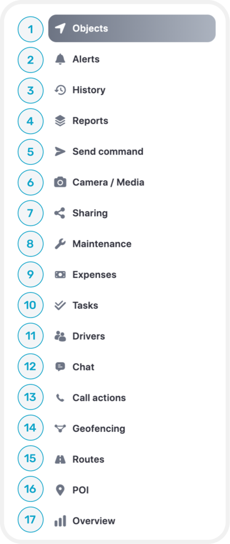
- Objects – View and manage devices.
- Alerts – Create an alert.
- History – View devices history of a selected period.
- Reports – Generate various reports.
- Send Command – Sending SMS/GPRS commands to a device.
- Camera/Media – View connected cameras and its content
- Sharing – Share devices location through a generated link.
- Maintenance – Create a maintenance schedule to follow.
- Expenses – Generate expenses for each device.
- Tasks – Generate tasks to complete based on priority, location and date.
- Drivers – Create a driver to assign a specific device.
- Chat – Allows you to communicate between users.
- Call Actions - Allows to add a description for each event of why the event has occurred.
- Geofencing – Select an area on the map to initialize the fence.
- Routes – Create a route from point A – B, has no extra functionality.
- POI – Allows to create positions of interest such as schools, markets etc.
- Overview - Displays useful information in a more comprehensive way.
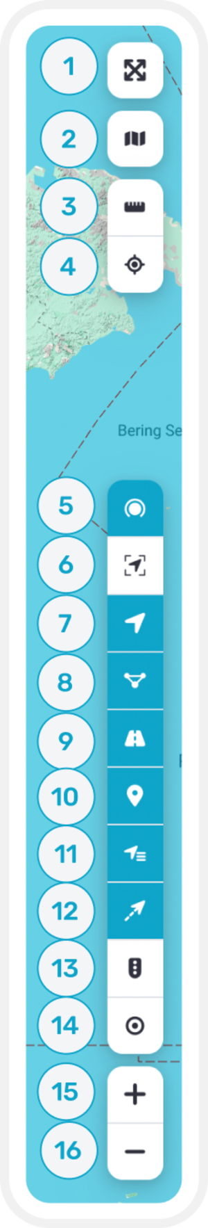
- Full screen mode – Hides additional tabs to display the map over full screen.
- Change map – Map change to different providers and modes.
- Ruller – When on, allows you to draw a marker from point A to B to calculate its real distance.
- Show addresses – Allows to find a saved location or by entering coordinates.
- Cluster – When enabled, objects with a close proximity positions are minimized into a one cluster.
- Fit Objects – Fits all the objects to visually fit on a map.
- Objects – Displays or removes objects out of the map.
- Geofences – Enables/Disables geofence areas displayed on the map.
- Routes - Displays or hides routes created on the map.
- POI - Enables or disables the display of the POI’s.
- Show Names - Displays names of the objects on top of them.
- Show tails -Displays or hides object tails on the map.
- Traffic - Shows traffic in the areas.
- My Location - Shows your current location
- Zoom in - Zooms in the map.
- Zoom out - Zooms out the map.